Compass Military Compass Army Compass Waterproof Shockproof with Carrying Bag, Used for Navigation, Aiming, Hunting, Hiking, Camping, Outdoor, Distance Calculation, Mountain Climbing

$45.99

  • 【Professional】 This professional military compass will always point you in the right direction. Ideal for camping, military use, emergencies, motor sports, boating, camping, mountaineering, exploring, hunting and in all situations where you need assistance on the beaten track.
  • 【Multi-functions】 2 rulers on the edge for topographic maps. Perfect for positioning, orienting on a map, plotting and so on. Basic orientation, site plan, azimuth side, deviation angle and measurement of the width of th object.
  • 【High Performance Engineer Metal】 The compass with high strength engineer metal case, durable, can work in extreme weather conditions. This professional lens compass is super light and built to the highest standards to ensure it’s ready when you need it.
  • 【Fluorescent, Waterproof and Shake Resistant】 After absorbing enough sunshine, the surface of the compass glows in the dark to guide you safely even at night. The built-in level can improve its accuracy and reduce erors.
  • 【Portable】 Carry the compass directly on your body thanks to the belt loop or stow it securely in your pocket with the carrying case so that you can keep your hands on the mountain when climbing.

In stock

— OR  —

— OR  —

  • International Express shipping available
  • 30 day easy returns
Guaranteed Safe Checkout

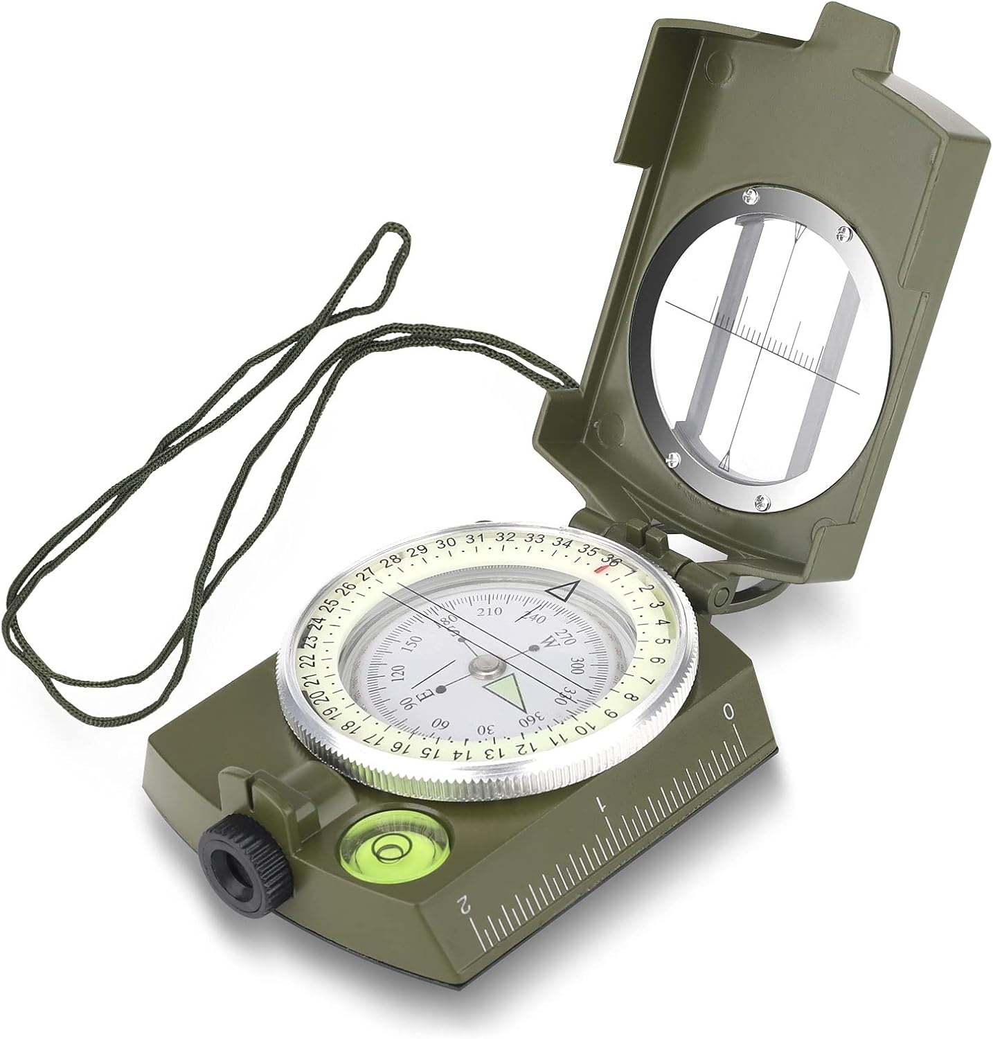
Product information:
Name: Compass
Color: army green
Specification: 85 * 53 * 30mm
Material: high strength zinc alloy, tempered glass
Weight: 185g
Function introduction: basic positioning, map positioning, lateral azimuth angle, deflection angle, measurement of the target object width, etc.

Product instructions:
1. The correct way to determine north is this, the center of the palm is flat and the arrow (N pole) is north referring to.
2. Determine your exact location using the landmarks and the map: Select two visible landmarks with different azimuths, measure the respective azimuth angles and draw the intersection of the two. Azimuth extension lines on the map, is where you are.
3. When marching at night or in rough terrain, first point north to north and then rotate the engraved line on the bearing table to the azimuth of the target so that you can confirm the direction of travel at any time. just walk in the direction indicated by the engraved line.
4. Magnetic declination measurement: On a clear night, turn the azimuth plate so that the long line on the azimuth plate is directly opposite the direction indicator. Aim the small lens through the thin metal wire in the slot, of the north arrow to the north star without changing the direction of the north arrow.

Maintenance:
Compass not to ferromagnetic objects, high-voltage lines, electromagnetic devices, etc, so as not to cause errors and to reduce the sensitivity of the compass.

Additional information

Weight 0.2 kg
brand

Rhinocerosdance

dimensions

‎11.4 x 8.3 x 4.6 cm; 190 Grams